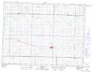
Maps showing Redvers, 13-7-32-W, Saskatchewan
Redvers is a Town located in 13-7-32-W, Saskatchewan and has an elevation of 591 meters.
- Latitude: 49° 34' 14'' North (decimal: 49.5704222)
- Longitude: 101° 42' 8'' West (decimal: -101.7023505)
- Topography Feature Category: Town
- Geographical Feature: Town
- Canadian Province/Territory: Saskatchewan
- Elevation: 591 meters
- Location: 13-7-32-W
- Atlas of Canada Locator Map: Redvers
- GPS Coordinate Locator Map: Redvers Lat/Long