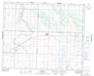
Maps showing Rhyl, 21-36-10-W3, Saskatchewan
Rhyl is a Unincorporated area located in 21-36-10-W3, Saskatchewan.
- Latitude: 52° 6' North (decimal: 52.1000468)
- Longitude: 107° 22' West (decimal: -107.3673098)
- Topography Feature Category: Unincorporated area
- Geographical Feature: Railway Point
- Canadian Province/Territory: Saskatchewan
- Location: 21-36-10-W3
- Atlas of Canada Locator Map: Rhyl
- GPS Coordinate Locator Map: Rhyl Lat/Long