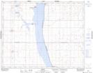
Maps showing Etters Beach, 21-26-24-W2, Saskatchewan
Etters Beach is a Village located in 21-26-24-W2, Saskatchewan and has an elevation of 500 meters.
- Latitude: 51° 14' 6'' North (decimal: 51.2350271)
- Longitude: 105° 17' 56'' West (decimal: -105.2989611)
- Topography Feature Category: Village
- Geographical Feature: Resort Village
- Canadian Province/Territory: Saskatchewan
- Elevation: 500 meters
- Location: 21-26-24-W2
- Atlas of Canada Locator Map: Etters Beach
- GPS Coordinate Locator Map: Etters Beach Lat/Long