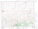
Maps showing Udal Coulee, 10,11-25-W3, Saskatchewan
Udal Coulee is a Valley located in 10,11-25-W3, Saskatchewan and has an elevation of 843 meters.
- Latitude: 49° 53' North (decimal: 49.8833706)
- Longitude: 109° 19' West (decimal: -109.3174135)
- Topography Feature Category: Valley
- Geographical Feature: Coulee
- Canadian Province/Territory: Saskatchewan
- Elevation: 843 meters
- Location: 10,11-25-W3
- Atlas of Canada Locator Map: Udal Coulee
- GPS Coordinate Locator Map: Udal Coulee Lat/Long
Udal Coulee NTS Map Sheets