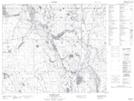
Maps showing Upper Fishing Lake, 58-18-W2, Saskatchewan
Upper Fishing Lake is a Lake located in 58-18-W2, Saskatchewan and has an elevation of 514 meters.
- Latitude: 54° 3' North (decimal: 54.0500569)
- Longitude: 104° 39' West (decimal: -104.6504364)
- Topography Feature Category: Lake
- Geographical Feature: Lake
- Canadian Province/Territory: Saskatchewan
- Elevation: 514 meters
- Location: 58-18-W2
- Atlas of Canada Locator Map: Upper Fishing Lake
- GPS Coordinate Locator Map: Upper Fishing Lake Lat/Long
Upper Fishing Lake NTS Map Sheets