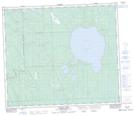
Maps showing Utikumak (White Fish) Lake, 67-15-W3, Saskatchewan
Utikumak (White Fish) Lake is a Lake located in 67-15-W3, Saskatchewan and has an elevation of 465 meters.
- Latitude: 54° 50' North (decimal: 54.8334207)
- Longitude: 108° 14' West (decimal: -108.2340485)
- Topography Feature Category: Lake
- Geographical Feature: Lake
- Canadian Province/Territory: Saskatchewan
- Elevation: 465 meters
- Location: 67-15-W3
- Atlas of Canada Locator Map: Utikumak (White Fish) Lake
- GPS Coordinate Locator Map: Utikumak (White Fish) Lake Lat/Long
Utikumak (White Fish) Lake NTS Map Sheets