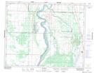
Maps showing Valley Park, 33-6-W3, Saskatchewan
Valley Park is a Unincorporated area located in 33-6-W3, Saskatchewan.
- Latitude: 51° 51' North (decimal: 51.8500414)
- Longitude: 106° 47' West (decimal: -106.7839568)
- Topography Feature Category: Unincorporated area
- Geographical Feature: Locality
- Canadian Province/Territory: Saskatchewan
- Location: 33-6-W3
- Atlas of Canada Locator Map: Valley Park
- GPS Coordinate Locator Map: Valley Park Lat/Long