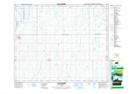
Maps showing Vanderlinde Lake, 2,11-39-20-W2, Saskatchewan
Vanderlinde Lake is a Lake located in 2,11-39-20-W2, Saskatchewan and has an elevation of 579 meters.
- Latitude: 52° 20' North (decimal: 52.3333514)
- Longitude: 104° 46' West (decimal: -104.7671960)
- Topography Feature Category: Lake
- Geographical Feature: Lake
- Canadian Province/Territory: Saskatchewan
- Elevation: 579 meters
- Location: 2,11-39-20-W2
- Atlas of Canada Locator Map: Vanderlinde Lake
- GPS Coordinate Locator Map: Vanderlinde Lake Lat/Long
Vanderlinde Lake NTS Map Sheets