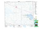
Maps showing Van Pattens Creek, 25-33-12-W2, Saskatchewan
Van Pattens Creek is a River located in 25-33-12-W2, Saskatchewan and has an elevation of 545 meters.
- Latitude: 51° 52' North (decimal: 51.8666630)
- Longitude: 103° 35' West (decimal: -103.5838368)
- Topography Feature Category: River
- Geographical Feature: Creek
- Canadian Province/Territory: Saskatchewan
- Elevation: 545 meters
- Location: 25-33-12-W2
- Atlas of Canada Locator Map: Van Pattens Creek
- GPS Coordinate Locator Map: Van Pattens Creek Lat/Long