Maps showing Smith Rapids, Saskatchewan
Smith Rapids is a Rapids located in Saskatchewan.
- Latitude: 59° 25' North (decimal: 59.4170842)
- Longitude: 107° 11' West (decimal: -107.1844344)
- Topography Feature Category: Rapids
- Geographical Feature: Rapids
- Canadian Province/Territory: Saskatchewan
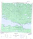
- Atlas of Canada Locator Map: Smith Rapids
- GPS Coordinate Locator Map: Smith Rapids Lat/Long
Smith Rapids NTS Map Sheets