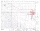
Maps showing Snowdys Springs, 9-16-27-W2, Saskatchewan
Snowdys Springs is a Spring located in 9-16-27-W2, Saskatchewan and has an elevation of 580 meters.
- Latitude: 50° 19' North (decimal: 50.3166933)
- Longitude: 105° 39' West (decimal: -105.6505777)
- Topography Feature Category: Spring
- Geographical Feature: Springs
- Canadian Province/Territory: Saskatchewan
- Elevation: 580 meters
- Location: 9-16-27-W2
- Atlas of Canada Locator Map: Snowdys Springs
- GPS Coordinate Locator Map: Snowdys Springs Lat/Long