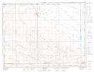
Maps showing Souris Valley, 36-5-17-W2, Saskatchewan
Souris Valley is a Unincorporated area located in 36-5-17-W2, Saskatchewan.
- Latitude: 49° 26' North (decimal: 49.4333644)
- Longitude: 104° 10' West (decimal: -104.1671969)
- Topography Feature Category: Unincorporated area
- Geographical Feature: Railway Point
- Canadian Province/Territory: Saskatchewan
- Location: 36-5-17-W2
- Atlas of Canada Locator Map: Souris Valley
- GPS Coordinate Locator Map: Souris Valley Lat/Long
Souris Valley NTS Map Sheets