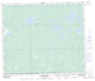
Maps showing South Twin Lake, 15-66-22-W3, Saskatchewan
South Twin Lake is a Lake located in 15-66-22-W3, Saskatchewan and has an elevation of 637 meters.
- Latitude: 54° 43' North (decimal: 54.7167575)
- Longitude: 109° 15' West (decimal: -109.2507964)
- Topography Feature Category: Lake
- Geographical Feature: Lake
- Canadian Province/Territory: Saskatchewan
- Elevation: 637 meters
- Location: 15-66-22-W3
- Atlas of Canada Locator Map: South Twin Lake
- GPS Coordinate Locator Map: South Twin Lake Lat/Long
South Twin Lake NTS Map Sheets