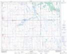
Maps showing Spalding, 2-39-18-W2, Saskatchewan
Spalding is a Village located in 2-39-18-W2, Saskatchewan and has an elevation of 560 meters.
- Latitude: 52° 19' 45'' North (decimal: 52.3291028)
- Longitude: 104° 29' 45'' West (decimal: -104.4957194)
- Topography Feature Category: Village
- Geographical Feature: Village
- Canadian Province/Territory: Saskatchewan
- Elevation: 560 meters
- Location: 2-39-18-W2
- Atlas of Canada Locator Map: Spalding
- GPS Coordinate Locator Map: Spalding Lat/Long
Spalding NTS Map Sheets