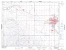
Maps showing Richards Coulee, 17-28-W2, Saskatchewan
Richards Coulee is a Valley located in 17-28-W2, Saskatchewan and has an elevation of 584 meters.
- Latitude: 50° 28' North (decimal: 50.4666983)
- Longitude: 105° 50' West (decimal: -105.8339188)
- Topography Feature Category: Valley
- Geographical Feature: Coulee
- Canadian Province/Territory: Saskatchewan
- Elevation: 584 meters
- Location: 17-28-W2
- Atlas of Canada Locator Map: Richards Coulee
- GPS Coordinate Locator Map: Richards Coulee Lat/Long