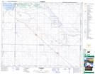
Maps showing Ridge Creek, 21-23-3-W3, Saskatchewan
Ridge Creek is a River located in 21-23-3-W3, Saskatchewan and has an elevation of 573 meters.
- Latitude: 50° 58' North (decimal: 50.9666977)
- Longitude: 106° 22' West (decimal: -106.3672825)
- Topography Feature Category: River
- Geographical Feature: Creek
- Canadian Province/Territory: Saskatchewan
- Elevation: 573 meters
- Location: 21-23-3-W3
- Atlas of Canada Locator Map: Ridge Creek
- GPS Coordinate Locator Map: Ridge Creek Lat/Long
Ridge Creek NTS Map Sheets