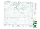
Maps showing Rocanville, 21-16-31-W, Saskatchewan
Rocanville is a Town located in 21-16-31-W, Saskatchewan and has an elevation of 522 meters.
- Latitude: 50° 22' 48'' North (decimal: 50.3800639)
- Longitude: 101° 41' 26'' West (decimal: -101.6906027)
- Topography Feature Category: Town
- Geographical Feature: Town
- Canadian Province/Territory: Saskatchewan
- Elevation: 522 meters
- Location: 21-16-31-W
- Atlas of Canada Locator Map: Rocanville
- GPS Coordinate Locator Map: Rocanville Lat/Long
Rocanville NTS Map Sheets