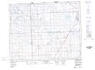
Maps showing Rock Dell, 22-25-7-W2, Saskatchewan
Rock Dell is a Unincorporated area located in 22-25-7-W2, Saskatchewan.
- Latitude: 51° 11' North (decimal: 51.1833331)
- Longitude: 102° 54' West (decimal: -102.9004914)
- Topography Feature Category: Unincorporated area
- Geographical Feature: Locality
- Canadian Province/Territory: Saskatchewan
- Location: 22-25-7-W2
- Atlas of Canada Locator Map: Rock Dell
- GPS Coordinate Locator Map: Rock Dell Lat/Long
Rock Dell NTS Map Sheets