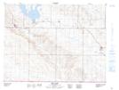
Maps showing Rockglen, 2-3-30-W2, Saskatchewan
Rockglen is a Town located in 2-3-30-W2, Saskatchewan and has an elevation of 836 meters.
- Latitude: 49° 10' 53'' North (decimal: 49.1812832)
- Longitude: 105° 56' 51'' West (decimal: -105.9476082)
- Topography Feature Category: Town
- Geographical Feature: Town
- Canadian Province/Territory: Saskatchewan
- Elevation: 836 meters
- Location: 2-3-30-W2
- Atlas of Canada Locator Map: Rockglen
- GPS Coordinate Locator Map: Rockglen Lat/Long
Rockglen NTS Map Sheets