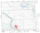
Maps showing Rosalie Hill, Saskatchewan
Rosalie Hill is a Mountain located in Saskatchewan and has an elevation of 518 meters.
- Latitude: 52° 48' North (decimal: 52.8000684)
- Longitude: 108° 23' West (decimal: -108.3840163)
- Topography Feature Category: Mountain
- Geographical Feature: Hill
- Canadian Province/Territory: Saskatchewan
- Elevation: 518 meters
- Atlas of Canada Locator Map: Rosalie Hill
- GPS Coordinate Locator Map: Rosalie Hill Lat/Long
Rosalie Hill NTS Map Sheets