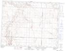
Maps showing Rosengart, 15-14-13-W3, Saskatchewan
Rosengart is a Unincorporated area located in 15-14-13-W3, Saskatchewan and has an elevation of 859 meters.
- Latitude: 50° 11' North (decimal: 50.1833661)
- Longitude: 107° 43' West (decimal: -107.7173384)
- Topography Feature Category: Unincorporated area
- Geographical Feature: Locality
- Canadian Province/Territory: Saskatchewan
- Elevation: 859 meters
- Location: 15-14-13-W3
- Atlas of Canada Locator Map: Rosengart
- GPS Coordinate Locator Map: Rosengart Lat/Long
Rosengart NTS Map Sheets