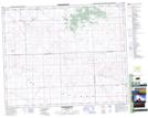
Maps showing Ruthilda, 3-34-18-W3, Saskatchewan
Ruthilda is a Village located in 3-34-18-W3, Saskatchewan and has an elevation of 695 meters.
- Latitude: 51° 53' 33'' North (decimal: 51.8925833)
- Longitude: 108° 28' 2'' West (decimal: -108.4671783)
- Topography Feature Category: Village
- Geographical Feature: Village
- Canadian Province/Territory: Saskatchewan
- Elevation: 695 meters
- Location: 3-34-18-W3
- Atlas of Canada Locator Map: Ruthilda
- GPS Coordinate Locator Map: Ruthilda Lat/Long
Ruthilda NTS Map Sheets