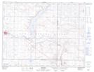
Maps showing Verwood, 31-6-27-W2, Saskatchewan
Verwood is a Unincorporated area located in 31-6-27-W2, Saskatchewan and has an elevation of 713 meters.
- Latitude: 49° 31' North (decimal: 49.5166953)
- Longitude: 105° 37' West (decimal: -105.6172298)
- Topography Feature Category: Unincorporated area
- Geographical Feature: Hamlet
- Canadian Province/Territory: Saskatchewan
- Elevation: 713 meters
- Location: 31-6-27-W2
- Atlas of Canada Locator Map: Verwood
- GPS Coordinate Locator Map: Verwood Lat/Long
Verwood NTS Map Sheets