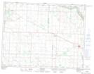
Maps showing Walpole, 36-10-33-W, Saskatchewan
Walpole is a Unincorporated area located in 36-10-33-W, Saskatchewan and has an elevation of 610 meters.
- Latitude: 49° 53' North (decimal: 49.8833420)
- Longitude: 101° 50' West (decimal: -101.8338185)
- Topography Feature Category: Unincorporated area
- Geographical Feature: Hamlet
- Canadian Province/Territory: Saskatchewan
- Elevation: 610 meters
- Location: 36-10-33-W
- Atlas of Canada Locator Map: Walpole
- GPS Coordinate Locator Map: Walpole Lat/Long