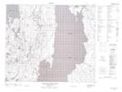
Maps showing Wanner Lake, 62,63-26,27-W2, Saskatchewan
Wanner Lake is a Lake located in 62,63-26,27-W2, Saskatchewan and has an elevation of 607 meters.
- Latitude: 54° 25' North (decimal: 54.4167175)
- Longitude: 105° 56' West (decimal: -105.9338167)
- Topography Feature Category: Lake
- Geographical Feature: Lake
- Canadian Province/Territory: Saskatchewan
- Elevation: 607 meters
- Location: 62,63-26,27-W2
- Atlas of Canada Locator Map: Wanner Lake
- GPS Coordinate Locator Map: Wanner Lake Lat/Long
Wanner Lake NTS Map Sheets