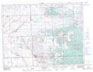
Maps showing Warmley, 7-10-5-W2, Saskatchewan
Warmley is a Unincorporated area located in 7-10-5-W2, Saskatchewan and has an elevation of 777 meters.
- Latitude: 49° 48' North (decimal: 49.8000199)
- Longitude: 102° 41' West (decimal: -102.6838240)
- Topography Feature Category: Unincorporated area
- Geographical Feature: Locality
- Canadian Province/Territory: Saskatchewan
- Elevation: 777 meters
- Location: 7-10-5-W2
- Atlas of Canada Locator Map: Warmley
- GPS Coordinate Locator Map: Warmley Lat/Long