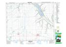
Maps showing Springbrook Creek, 3-20-14-W2, Saskatchewan
Springbrook Creek is a River located in 3-20-14-W2, Saskatchewan and has an elevation of 611 meters.
- Latitude: 50° 40' North (decimal: 50.6667002)
- Longitude: 103° 51' West (decimal: -103.8505186)
- Topography Feature Category: River
- Geographical Feature: Creek
- Canadian Province/Territory: Saskatchewan
- Elevation: 611 meters
- Location: 3-20-14-W2
- Atlas of Canada Locator Map: Springbrook Creek
- GPS Coordinate Locator Map: Springbrook Creek Lat/Long
Springbrook Creek NTS Map Sheets