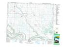
Maps showing Spy Hill, 2-19-31-W, Saskatchewan
Spy Hill is a Village located in 2-19-31-W, Saskatchewan and has an elevation of 477 meters.
- Latitude: 50° 36' 12'' North (decimal: 50.6032556)
- Longitude: 101° 41' 10'' West (decimal: -101.6860846)
- Topography Feature Category: Village
- Geographical Feature: Village
- Canadian Province/Territory: Saskatchewan
- Elevation: 477 meters
- Location: 2-19-31-W
- Atlas of Canada Locator Map: Spy Hill
- GPS Coordinate Locator Map: Spy Hill Lat/Long
Spy Hill NTS Map Sheets