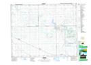
Maps showing Squirrel Hill, 19-17-13-W2, Saskatchewan
Squirrel Hill is a Mountain located in 19-17-13-W2, Saskatchewan and has an elevation of 665 meters.
- Latitude: 50° 29' North (decimal: 50.4833675)
- Longitude: 103° 47' West (decimal: -103.7838624)
- Topography Feature Category: Mountain
- Geographical Feature: Hill
- Canadian Province/Territory: Saskatchewan
- Elevation: 665 meters
- Location: 19-17-13-W2
- Atlas of Canada Locator Map: Squirrel Hill
- GPS Coordinate Locator Map: Squirrel Hill Lat/Long