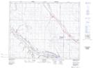
Maps showing Stark Coulee, 21-28-W2, Saskatchewan
Stark Coulee is a Valley located in 21-28-W2, Saskatchewan and has an elevation of 570 meters.
- Latitude: 50° 47' North (decimal: 50.7833654)
- Longitude: 105° 52' West (decimal: -105.8672586)
- Topography Feature Category: Valley
- Geographical Feature: Coulee
- Canadian Province/Territory: Saskatchewan
- Elevation: 570 meters
- Location: 21-28-W2
- Atlas of Canada Locator Map: Stark Coulee
- GPS Coordinate Locator Map: Stark Coulee Lat/Long