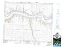
Maps showing Stewart Valley, 12-19-14-W3, Saskatchewan
Stewart Valley is a Village located in 12-19-14-W3, Saskatchewan and has an elevation of 711 meters.
- Latitude: 50° 35' 44'' North (decimal: 50.5955500)
- Longitude: 107° 48' 19'' West (decimal: -107.8053582)
- Topography Feature Category: Village
- Geographical Feature: Village
- Canadian Province/Territory: Saskatchewan
- Elevation: 711 meters
- Location: 12-19-14-W3
- Atlas of Canada Locator Map: Stewart Valley
- GPS Coordinate Locator Map: Stewart Valley Lat/Long
Stewart Valley NTS Map Sheets