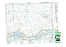
Maps showing Stockholm, 25-19-3-W2, Saskatchewan
Stockholm is a Village located in 25-19-3-W2, Saskatchewan and has an elevation of 535 meters.
- Latitude: 50° 39' 26'' North (decimal: 50.6571167)
- Longitude: 102° 18' 11'' West (decimal: -102.3029556)
- Topography Feature Category: Village
- Geographical Feature: Village
- Canadian Province/Territory: Saskatchewan
- Elevation: 535 meters
- Location: 25-19-3-W2
- Atlas of Canada Locator Map: Stockholm
- GPS Coordinate Locator Map: Stockholm Lat/Long