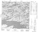
Maps showing Stoll Point, Saskatchewan
Stoll Point is a Cape located in Saskatchewan and has an elevation of 231 meters.
- Latitude: 59° 17' North (decimal: 59.2837722)
- Longitude: 106° 34' West (decimal: -106.5677388)
- Topography Feature Category: Cape
- Geographical Feature: Point
- Canadian Province/Territory: Saskatchewan
- Elevation: 231 meters
- Atlas of Canada Locator Map: Stoll Point
- GPS Coordinate Locator Map: Stoll Point Lat/Long
Stoll Point NTS Map Sheets