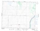
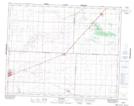
Maps showing Stonyridge Creek, 27-31-10-W3, Saskatchewan
Stonyridge Creek is a River located in 27-31-10-W3, Saskatchewan and has an elevation of 574 meters.
- Latitude: 51° 41' North (decimal: 51.6833755)
- Longitude: 107° 21' West (decimal: -107.3506497)
- Topography Feature Category: River
- Geographical Feature: Creek
- Canadian Province/Territory: Saskatchewan
- Elevation: 574 meters
- Location: 27-31-10-W3
- Atlas of Canada Locator Map: Stonyridge Creek
- GPS Coordinate Locator Map: Stonyridge Creek Lat/Long
Stonyridge Creek NTS Map Sheets