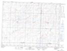
Maps showing Storthoaks, 16-5-31-W, Saskatchewan
Storthoaks is a Village located in 16-5-31-W, Saskatchewan and has an elevation of 543 meters.
- Latitude: 49° 23' 23'' North (decimal: 49.3895889)
- Longitude: 101° 36' 6'' West (decimal: -101.6017264)
- Topography Feature Category: Village
- Geographical Feature: Village
- Canadian Province/Territory: Saskatchewan
- Elevation: 543 meters
- Location: 16-5-31-W
- Atlas of Canada Locator Map: Storthoaks
- GPS Coordinate Locator Map: Storthoaks Lat/Long