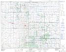
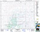
Maps showing Strangs Slough, 12-29-16-W2, Saskatchewan
Strangs Slough is a Low vegetation located in 12-29-16-W2, Saskatchewan and has an elevation of 636 meters.
- Latitude: 51° 30' North (decimal: 51.5000300)
- Longitude: 104° 9' West (decimal: -104.1505372)
- Topography Feature Category: Low vegetation
- Geographical Feature: Slough
- Canadian Province/Territory: Saskatchewan
- Elevation: 636 meters
- Location: 12-29-16-W2
- Atlas of Canada Locator Map: Strangs Slough
- GPS Coordinate Locator Map: Strangs Slough Lat/Long
Strangs Slough NTS Map Sheets