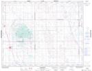
Maps showing Strasbourg, 25-24-22-W2, Saskatchewan
Strasbourg is a Town located in 25-24-22-W2, Saskatchewan and has an elevation of 544 meters.
- Latitude: 51° 4' 13'' North (decimal: 51.0702805)
- Longitude: 104° 57' 20'' West (decimal: -104.9555028)
- Topography Feature Category: Town
- Geographical Feature: Town
- Canadian Province/Territory: Saskatchewan
- Elevation: 544 meters
- Location: 25-24-22-W2
- Atlas of Canada Locator Map: Strasbourg
- GPS Coordinate Locator Map: Strasbourg Lat/Long