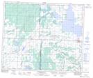
Maps showing Belbutte, 51-13-W3, Saskatchewan
Belbutte is a Unincorporated area located in 51-13-W3, Saskatchewan and has an elevation of 662 meters.
- Latitude: 53° 22' North (decimal: 53.3667390)
- Longitude: 107° 49' West (decimal: -107.8173043)
- Topography Feature Category: Unincorporated area
- Geographical Feature: Hamlet
- Canadian Province/Territory: Saskatchewan
- Elevation: 662 meters
- Location: 51-13-W3
- Atlas of Canada Locator Map: Belbutte
- GPS Coordinate Locator Map: Belbutte Lat/Long
Belbutte NTS Map Sheets