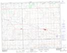
Maps showing Bender Lake, 13-4-W2, Saskatchewan
Bender Lake is a Lake located in 13-4-W2, Saskatchewan and has an elevation of 683 meters.
- Latitude: 50° 4' North (decimal: 50.0666831)
- Longitude: 102° 32' West (decimal: -102.5338312)
- Topography Feature Category: Lake
- Geographical Feature: Lake
- Canadian Province/Territory: Saskatchewan
- Elevation: 683 meters
- Location: 13-4-W2
- Atlas of Canada Locator Map: Bender Lake
- GPS Coordinate Locator Map: Bender Lake Lat/Long