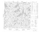
Maps showing Bertrand Bay, Saskatchewan
Bertrand Bay is a Bay located in Saskatchewan and has an elevation of 401 meters.
- Latitude: 59° 41' North (decimal: 59.6836848)
- Longitude: 106° 33' West (decimal: -106.5509659)
- Topography Feature Category: Bay
- Geographical Feature: Bay
- Canadian Province/Territory: Saskatchewan
- Elevation: 401 meters
- Atlas of Canada Locator Map: Bertrand Bay
- GPS Coordinate Locator Map: Bertrand Bay Lat/Long
Bertrand Bay NTS Map Sheets