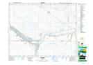
Maps showing Bethune, 24-20-24-W2, Saskatchewan
Bethune is a Village located in 24-20-24-W2, Saskatchewan and has an elevation of 552 meters.
- Latitude: 50° 42' 39'' North (decimal: 50.7108110)
- Longitude: 105° 12' 19'' West (decimal: -105.2052666)
- Topography Feature Category: Village
- Geographical Feature: Village
- Canadian Province/Territory: Saskatchewan
- Elevation: 552 meters
- Location: 24-20-24-W2
- Atlas of Canada Locator Map: Bethune
- GPS Coordinate Locator Map: Bethune Lat/Long