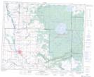
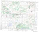
Maps showing Bear Head Creek, 36-34-30-W, Saskatchewan
Bear Head Creek is a River located in 36-34-30-W, Saskatchewan and has an elevation of 568 meters.
- Latitude: 51° 58' North (decimal: 51.9666617)
- Longitude: 101° 35' West (decimal: -101.5837885)
- Topography Feature Category: River
- Geographical Feature: Creek
- Canadian Province/Territory: Saskatchewan
- Elevation: 568 meters
- Location: 36-34-30-W
- Atlas of Canada Locator Map: Bear Head Creek
- GPS Coordinate Locator Map: Bear Head Creek Lat/Long
Bear Head Creek NTS Map Sheets