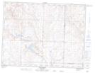
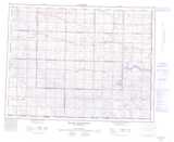
Maps showing Beaver Valley, 18-6-13-W3, Saskatchewan
Beaver Valley is a Unincorporated area located in 18-6-13-W3, Saskatchewan and has an elevation of 877 meters.
- Latitude: 49° 28' North (decimal: 49.4666909)
- Longitude: 107° 45' West (decimal: -107.7506600)
- Topography Feature Category: Unincorporated area
- Geographical Feature: Locality
- Canadian Province/Territory: Saskatchewan
- Elevation: 877 meters
- Location: 18-6-13-W3
- Atlas of Canada Locator Map: Beaver Valley
- GPS Coordinate Locator Map: Beaver Valley Lat/Long
Beaver Valley NTS Map Sheets