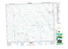
Maps showing Bredenbury, 35-22-1-W2, Saskatchewan
Bredenbury is a Town located in 35-22-1-W2, Saskatchewan and has an elevation of 523 meters.
- Latitude: 50° 56' 29'' North (decimal: 50.9412527)
- Longitude: 102° 2' 39'' West (decimal: -102.0440444)
- Topography Feature Category: Town
- Geographical Feature: Town
- Canadian Province/Territory: Saskatchewan
- Elevation: 523 meters
- Location: 35-22-1-W2
- Atlas of Canada Locator Map: Bredenbury
- GPS Coordinate Locator Map: Bredenbury Lat/Long
Bredenbury NTS Map Sheets