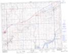
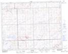
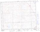
Maps showing Bridge Creek, 15-18-W3, Saskatchewan
Bridge Creek is a River located in 15-18-W3, Saskatchewan and has an elevation of 790 meters.
- Latitude: 50° 15' North (decimal: 50.2500400)
- Longitude: 108° 24' West (decimal: -108.4006981)
- Topography Feature Category: River
- Geographical Feature: Creek
- Canadian Province/Territory: Saskatchewan
- Elevation: 790 meters
- Location: 15-18-W3
- Atlas of Canada Locator Map: Bridge Creek
- GPS Coordinate Locator Map: Bridge Creek Lat/Long
Bridge Creek NTS Map Sheets
072F15 Skull Creek Topographic Map at 1:50,000 scale
072K01 Gull Lake Topographic Map at 1:50,000 scale
072K02 Tompkins Topographic Map at 1:50,000 scale
072K08 Roseray Topographic Map at 1:50,000 scale
072F Cypress Lake Topographic Map at 1:250,000 scale
072K Prelate Topographic Map at 1:250,000 scale
072K01 Gull Lake Topographic Map at 1:50,000 scale
072K02 Tompkins Topographic Map at 1:50,000 scale
072K08 Roseray Topographic Map at 1:50,000 scale
072F Cypress Lake Topographic Map at 1:250,000 scale
072K Prelate Topographic Map at 1:250,000 scale