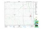
Maps showing Brooksby, 30-46-16-W2, Saskatchewan
Brooksby is a Unincorporated area located in 30-46-16-W2, Saskatchewan and has an elevation of 435 meters.
- Latitude: 53° 0' North (decimal: 53.0000174)
- Longitude: 104° 19' West (decimal: -104.3171422)
- Topography Feature Category: Unincorporated area
- Geographical Feature: Hamlet
- Canadian Province/Territory: Saskatchewan
- Elevation: 435 meters
- Location: 30-46-16-W2
- Atlas of Canada Locator Map: Brooksby
- GPS Coordinate Locator Map: Brooksby Lat/Long
Brooksby NTS Map Sheets