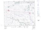
Maps showing Brown Hill Reservoir, 16-7-W2, Saskatchewan
Brown Hill Reservoir is a Lake located in 16-7-W2, Saskatchewan and has an elevation of 621 meters.
- Latitude: 50° 23' North (decimal: 50.3833520)
- Longitude: 102° 57' West (decimal: -102.9505100)
- Topography Feature Category: Lake
- Geographical Feature: Reservoir
- Canadian Province/Territory: Saskatchewan
- Elevation: 621 meters
- Location: 16-7-W2
- Atlas of Canada Locator Map: Brown Hill Reservoir
- GPS Coordinate Locator Map: Brown Hill Reservoir Lat/Long