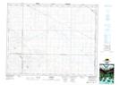
Maps showing Brownlee, 36-20-1-W3, Saskatchewan
Brownlee is a Village located in 36-20-1-W3, Saskatchewan and has an elevation of 614 meters.
- Latitude: 50° 44' 22'' North (decimal: 50.7394360)
- Longitude: 106° 0' 58'' West (decimal: -106.0162138)
- Topography Feature Category: Village
- Geographical Feature: Village
- Canadian Province/Territory: Saskatchewan
- Elevation: 614 meters
- Location: 36-20-1-W3
- Atlas of Canada Locator Map: Brownlee
- GPS Coordinate Locator Map: Brownlee Lat/Long
Brownlee NTS Map Sheets