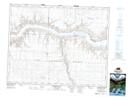
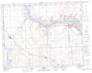
Maps showing Brunyee Coulee, 19-15-W3, Saskatchewan
Brunyee Coulee is a Valley located in 19-15-W3, Saskatchewan and has an elevation of 685 meters.
- Latitude: 50° 38' North (decimal: 50.6333732)
- Longitude: 108° 0' West (decimal: -108.0006828)
- Topography Feature Category: Valley
- Geographical Feature: Coulee
- Canadian Province/Territory: Saskatchewan
- Elevation: 685 meters
- Location: 19-15-W3
- Atlas of Canada Locator Map: Brunyee Coulee
- GPS Coordinate Locator Map: Brunyee Coulee Lat/Long
Brunyee Coulee NTS Map Sheets