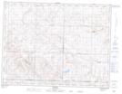
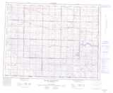
Maps showing Bullrun Coulee, 4-8-W3, Saskatchewan
Bullrun Coulee is a Valley located in 4-8-W3, Saskatchewan and has an elevation of 841 meters.
- Latitude: 49° 18' North (decimal: 49.3000282)
- Longitude: 107° 1' West (decimal: -107.0172859)
- Topography Feature Category: Valley
- Geographical Feature: Coulee
- Canadian Province/Territory: Saskatchewan
- Elevation: 841 meters
- Location: 4-8-W3
- Atlas of Canada Locator Map: Bullrun Coulee
- GPS Coordinate Locator Map: Bullrun Coulee Lat/Long
Bullrun Coulee NTS Map Sheets